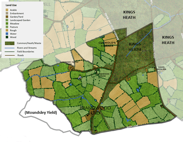
Before becoming part of the city of Birmingham in 1911 Brandwood End used to be part of Kings Norton Parish in the county of Worcestershire. Kings Norton Parish was divided into different Yields for tax reasons and Brandwood End was mostly in the Moseley Yield along with Moseley, Balsall Heath and Kings Heath.
Defining the boundaries of the Brandwood End map were a little tricky as the settlement has historically been considered as part of Kings Heath. For the purposes of the map the southern boundary has been defined as following Broad Lane and Tunnel Lane, including a small section of land within the Moundsley Yield up to Lifford Reservoir. The western boundary follows firstly the River Rea and then the (then) recently-constructed Birmingham and Gloucester Railway. The northern boundary was trickier, but in the end I decided to look at the land ownership to exclude areas owned by Trustees of the late William Anderton, whose land stretched north of Bleak Lane (now Vicarage Road) all the way to the railway and included parts of Kings Heath. The eastern boundary is formed by the Alcester Turnpike Road (now Alcester Road South).
Brandwood End before 1838
The map below shows Brandwood End how it may have appeared in around 1770 before the enclosure of the heath. No detailed maps exist for Brandwood End for this time so this map is conjectural and is based on the following sources:
- Birmingham and Gloucester Railway Plans and Sections (1835)
- 1840 Tithe Award Map –
- Moseley Yield, Kings Norton Parish
- The Birmingham Historic Landscape Characterisation (HLC) (2015) – Kings Norton Enclosures (1772), Kings Norton Enclosured Heaths (Others)
- F. Hopkins (1984) Kings Norton Commons and Wastes. Kings Norton Local History
The land between Woodthorpe Road and Featherstone Road would have existed as open unenclosed common which formed part of the Kings Heath, which extended northwards. This land was enclosed in 1772 to form mostly arable land. On the edge of the heath there would have existed isolated scattered settlements, such as Brandwood House.
Brandwood End in 1838
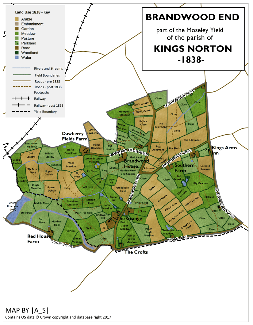
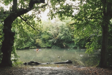
The area at this time was overwhelmingly rural, with the land use consisting of meadows, pastures and arable land. To the west the land drained towards the River Rea via two tributaries including Brandwood Brook and, further north, Dawberry Fields Brook. Lifford Reservoir, constructed in 1815, is the largest waterbody in this area. To the west Brandwood End drains towards the River Cole via its tributaries Haunch Brook and Chinn Brook.
By 1838 the following roads already existed:
| Present Day Name | Tithe Map Name (1838) | Other Names |
| Brandwood Road |
Brandwood End Road
|
|
| Featherstone Road | Road | |
| Dawberry Fields Road | Road | |
| Woodthorpe Road | Road | |
| Broad Lane | Broad Lane |
Brandwood End Hamlet
On the 1838 map Brandwood End is shown as a series of scattered farms with a tiny hamlet based around the southern end of Brandwood End Road (now Brandwood Road) consisting of a couple of unnamed farms and associated houses. One of these farms, which was owned by Joseph Ward Allen, but rented out to Thomas Hollington, is later marked as ‘The Grange’ on an 1880’s map of the area.
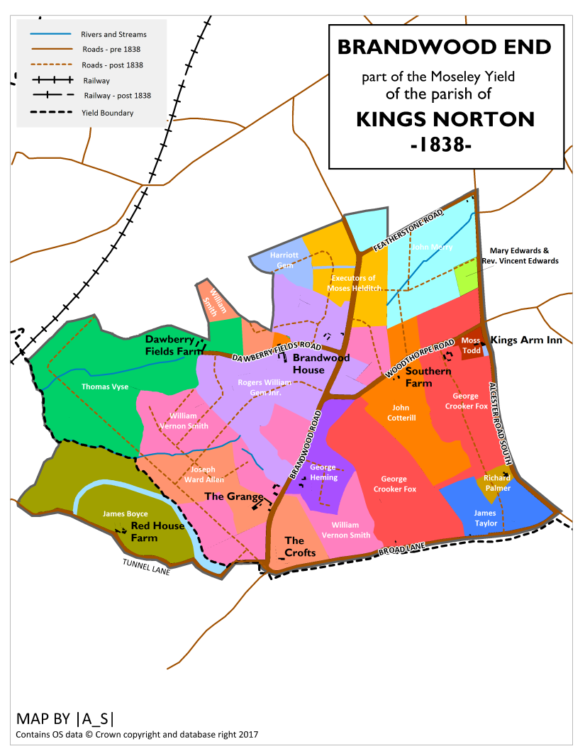
The other farm in this location was owned by William Vernon Smith who also owned several scattered parcels of farmland, rented out to various tenants.
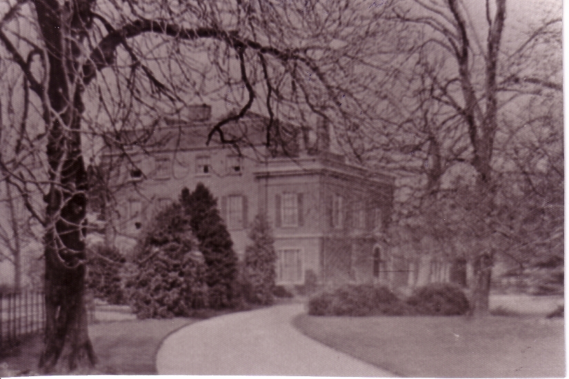
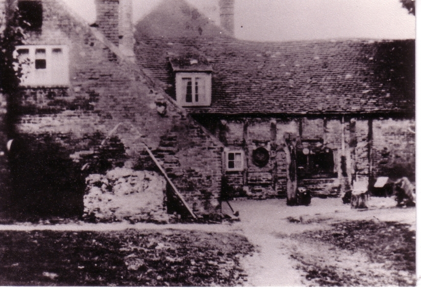
Brandwood House
Other major farms included Brandwood House, just south of Dawberry Fields Road, which was then owned and occupied by Roger William Gem Jnr. As well as the house itself there was associated offices, lawn and garden. Next to the house was a farm, also owned by Roger William Gem Jnr. but rented out to Henry Bridgens. Brandwood House itself was thought to date from at least 1638.
To the north east of the house on Brandwood End Road, Roger William Gem Jnr. also owned 5 houses which were occupied by various tenants.
Cuckold’s Corner
This was the name given to the junction of Featherstone Road and Brandwood End Road
Dawberry Fields Farm
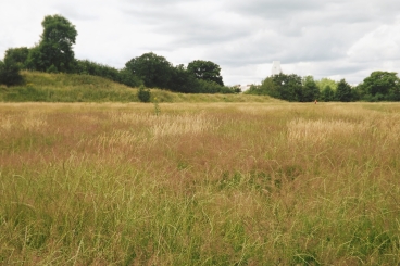
At the end of Dawberry Fields Road was Dawberry Fields Farm, owned by Thomas Vyse but rented to Edward Smith. This farm extended westwards to the River Rea, based around the valley of the Dawberry Fields Brook. Part of this land now forms part of the current day Dawberry Fields Park. The farm pond shown on the 1838 map still exists as a damp hollow here.

Red House Farm
South of this area, and just off Tunnel Lane was Red House Farm which was owned by James Boyce, who also owned the eastern half of Lifford Reservoir. This land was rented to Joseph Cash. Some of these fields forms part of the modern day Brandwood Sports Ground.
East of Brandwood Road and up to the junction with Woodthorpe Road lay a farm owned by George Heming, including a farmhouse with associated orchard, yard and gardens. The farm was tenanted by George Abbot.
South of Woodthorpe Road there were two further farms, the first of these (moving eastwards) was Southern Farm – owned by John Cotterill and tenanted by William Kendall. Surrounding this farm was a much larger farm owned by George Crooker Fox and tenanted by Thomas Mason. This farm extended up to the Turnpike Road (now Alcester Road South). Part of this farmland became the modern day Brandwood End Cemetery where some of the old field boundaries still survive. The pool which lay in Middle Leasow still exists today.
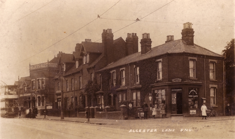
Kings Arms Inn
At the junction of Woodthorpe Road and the Turnpike Road was the Kings Arms Inn, which was then owned by Moss Todd. This is the present day location of The Crown pub.
The farmland to the north of Woodthorpe Road had been open common land up until 1799 and formed part of the King’s Heath. The field pattern here shows the characteristically straight field boundaries of the more recent enclosures.
Further Reading
Some of this article was written with the help of the research of Kings Heath Local History Society. If you would like to read more about the history of Kings Heath then their website if invaluable.
For more information on the history of Brandwood/Brandwood End see William Dargue’s excellent website here
Other Parts of Kings Norton Parish:
Moseley | Balsall Heath | Kings Heath | Brandwood End | Stirchley | Cotteridge | Haunch Heath

Reblogged this on Pilgrimpace's Blog.
LikeLike
Very interesting and Informative, our property overlooks dawberry fields park.
LikeLike