
After recently finishing my project to create hypothetical flags for some of the towns of the Black Country I decided to mark the upcoming Commonwealth Games by setting myself the challenge of creating hypothetical flags for some of the neighbourhoods in Birmingham.
When I began this project I didn’t quite appreciate how many areas of Birmingham there actually were! I tried to cover as many places as possible, trying to focus on those areas which had a long history and/or a strong sense of identity. The only places in Birmingham with existing official flags are Birmingham itself, and Digbeth. If you think I’ve missed anywhere important, please let me know in the comments below.
Recently more and more communities are designing and adopting their own official flags as a way of giving their neighborhood a visual identity or branding. If this post makes other communities in Birmingham consider officially adopting a flag, or if it prompts other people to attempt their own alternative designs, that would be brilliant! These flags I’ve devised are just one potential idea, I’m sure there are lots of budding flag designers with better ideas out there.
When designing a flag for a place I considered various things such as the history of the place, the place name, important historical people, local landmarks and buildings, natural features and even sports teams.
Some of the symbols and colours that make up the flags were given a lot of thought. Others were just chosen on a whim because I felt like it. Some of them I spent a substantial amount of time on, while some of them were just ‘phoned in’
If you would like to download and use these flags for any purpose please feel free to do so. I’d love to hear of any creative uses you find for them!
I’ve attempted to describe the reasoning behind each flag below. Additional historical information is mostly taken from William Dargue’s website A History of Birmingham Places and Placenames.
ACOCKS GREEN

Acocks Green was once part of the ancient parish of Yardley in the Pershore hundred of Worcestershire. Acocks Green became part of Birmingham in 1911.
Acocks Green is named after the Acock family, who had bought an estate then called Noting’s Land and built a large house there.
The flag design uses the image of a spread eagle, which was the name of one of the earliest pubs in the area, The Spread Eagle, which along with The Dolphins were two coaching inns which stood near to Acocks Green House in 1626. The original Spread Eagle Inn was demolished in the 1929 to make way for the widening of the Warwick Road, though the JD Wetherspoon pub now bears the same name.
The circle is to represent the fact that Acocks Green is the terminus of the No.11 bus route, which is often cited as Europe’s longest urban bus route.
The two diagonal lines represent the tram lines which also terminated here, and is now the location of the ‘green’ – which is represented by the green colour.
ALUM ROCK

Alum Rock was once part of the manor of Little Bromwich, which was part of the large ancient parish of Aston in the Hemlingford hundred of Warwickshire. Alum Rock became part of Birmingham in 1891.
The origin of the name Alum Rock is uncertain (it was first mentioned in 1718 as ‘Alom Rock’). It was not until after the First World War that the area began to be developed with housing.
The flag image is based on a logo I saw on an old Alum Rock Camporee scout badge from 1965. I liked it as a design as it reminded me of the Japanese prefecture flags.
ASTON

Aston was a manor within the much larger ancient parish of Aston in the Hemlingford hundred of Warwickshire.
The flag design is loosely based on the coat of arms of the former Aston Manor Urban District Council which existed from 1869 until it merged with Birmingham in 1911. This coat of arms in turn takes elements from the coat or arms of the Holte family who lived at Aston Hall for nearly 200 years and owned much property dating back to the 14th century.
BALSALL HEATH

Balsall Heath was once part of the Moseley yield of the ancient parish of Kings Norton in the Halfshire hundred of Worcestershire. Balsall Heath was annexed by Birmingham in 1891.
The central flag image is taken from a design above the men’s entrance of Moseley Road Baths. The Lion in the centre of the design is taken from the coat of arms of the Grevis family who used to own Moseley (you can see this coat of arms on the sign of the Old Moseley pub).
The archway is to represent both the railway bridges and the arched roof of the swimming baths. The yellow and orange represent the many large impressive red brick and terracotta buildings in this area.
BARTLEY GREEN

Bartley Green was once part of the ancient parish of Northfield in the Halfshire hundred of Worcestershire. It became part of Birmingham in 1911.
Both Bartley Green School and Bartley Green FC use a Tawny Owl on their badges so that’s why an owl image has been used. The water is to represent Bartley Reservoir – which is the main drinking water reservoir for Birmingham. It is also a renowned site for bird watching, which makes the owl even more appropriate. The green colour is to represent the ‘green’ of the place name.
BIRMINGHAM

This is the official Birmingham community flag that was adopted after a public competition in 2015, and was designed by 10 year old Thomas Keogh and David Smith. In the centre of the design is a golden bulls head to represent the Bull Ring market which stands at the geographic, economic and historic heart of the city.
BOURNVILLE

Bournville was once part of the ancient parish of Northfield in the Halfshire hundred of Worcestershire. It became part of Birmingham in 1911.
The flag design is based on the colours of the wrapper of the Bournville chocolate bar manufactured by Cadbury’s and the bottom stripe represents segments of chocolate.
CASTLE VALE

Castle Vale used to be known as Berwood. It was part of the township of Minworth in the parish of Curdworth in the Hemlingford hundred of Warwickshire.
In 1894 Berwood joined the newly formed Castle Bromwich Rural District, which itself became part of the Meriden Rural District in 1912. It became part of Birmingham in 1933.
From 1914 to 1958 the Castle Vale estate used to be the location of Castle Bromwich Aerodrome. Planes used to be built at a factory here so the flag has a spitfire on it, which also echoes the sculpture at Spitfire Island.
The colours are those of the Arden family who owned the nearby manor of Park Hall.
DIGBETH

This is an official flag that was designed by Adam Crossley and was adopted in 2015.
DRUIDS HEATH

Druids Heath was once part of the Moundsley yield of the ancient parish of Kings Norton in the Halfshire hundred of Worcestershire. It became part of Birmingham in 1911.
Though there is thought to be no link between the place name and actual Druids, I thought it would be an interesting idea to include a Celtic triskelion symbol. The blue stripes represent the tower blocks of the area (which are currently being demolished) while the green represents the nearby greenbelt.
EDGBASTON

Edgbaston was an ancient parish in the Hemlingford hundred of Warwickshire. It became part of Birmingham in 1838.
The colours of the flag are based on the coat of arms of the Calthorpe family, who are very influential in the area, while the towers represent the two towers of Perrott’s Folly and Edgbaston Waterworks Tower which were said to have inspired J.R.R. Tolkien when writing The Lord of the Rings.
ERDINGTON
Erdington was once a manor in the ancient parish of Aston in the Hemlingford hundred of Warwickshire. Erdington became a separate Urban District Council in 1894 until it merged with Birmingham in 1911.
The flag is based on the coat of arms of the former Erdington U.D. Council, which can be seen on the side of a building on the Erdington/Wylde Green border which was once the tram terminus for Erdington. It is based on the coat of arms of the Erdington family.
The powerful De Erdington family came to prominence around 1166 when Henry obtained the manorial rights from Gervais Pagenal of Dudley, thus beginning a long association between Erdington and the De Erdington family which lasted until 1467, when the family died out.
GRAVELLY HILL

Gravelly Hill was once part of Erdington Manor in the ancient parish of Aston in the Hemlingford hundred of Warwickshire. It became part of Birmingham in 1911.
The image shows Gravelly Hill Interchange (Spaghetti Junction) in a circle to represent the caves that were once here. The yellow hill represents the sandy soil of the area.
HALL GREEN

Hall Green was once part of the ancient parish of Yardley in the Pershore hundred of Worcestershire. Hall Green became part of Birmingham in 1911.
The area was thought to have been named after the Hawe family, so the flag uses the colours and pattern of the crest, with blue added to represent the river Cole.
The bull is to represent The Bulls Head Inn, which is or medieval origin.
HANDSWORTH

Handsworth was an ancient parish in the Offlow hundred of Staffordshire. Handsworth became part of Birmingham in 1911.
The flag design features a bugle, taken from the Coat of Arms of the Wyrley family who owned the manor for hundreds of years and it also represents the musical heritage of the area. The bugle string forms an upside down Staffordshire knot to reflect the areas former link with Staffordshire.
HARBORNE

Harborne was an ancient parish in the Offlow hundred of Staffordshire. Harborne became part of Birmingham in 1891.
The flag uses the upside down cross of St Peter (a church has stood here since Saxon times), while the bells represent The Bell pub which is over 300 years old. The colours are taken from Harborne Rugby Club.
HOCKLEY

Hockley was part of the ancient parish of Birmingham in the Hemlingford hundred of Warwickshire.
The flag includes an anchor, which represents Birmingham Assay Office, one of the four assay offices in the United Kingdom, which is located in the Jewellery Quarter.
The ring represents the important jewellery industry of the area.
HODGE HILL

Hodge Hill was part of Castle Bromwich in the ancient parish of Aston in the Hemlingford hundred of Warwickshire. In 1894 Castle Bromwich became a Rural District, which itself became part of the Meriden Rural District in 1912. It became part of Birmingham in 1933.
The flag design takes elements from the Chattock family coat of arms who owned Hay Hall, which is thought to have been the manor house of the area. Taken from the coat of arms is a martlet – which is a mythical bird without feet which never roosts from the moment of its drop-birth until its death-fall. The red and white colours are from the Chattock coat of arms while the yellow colour represents the sandy soil of the area.
KINGS HEATH

Kings Heath was once part of the Moseley yield of the ancient parish of Kings Norton in the Halfshire hundred of Worcestershire. Kings Heath became part of Birmingham in 1911.
The pear tree is to represents the pear tree which grew up the wall of the first pub in Kings Heath. The three pears also represent the area’s historical links with Worcestershire and also echos the badge of Kings Heath Cricket Club.
The crown represents that the area was once owned by the crown. The purple represents both royalty and heather, while the gold represents gorse.
KINGS NORTON

Kings Norton was a large ancient parish in the Halfshire hundred of Worcestershire. Kings Norton became part of Birmingham in 1911.
The crown shape represents that the area was once owned by the king. The wool pattern represents the early importance of the area for the wool trade (the Saracens Head used to be a wool merchant’s shop). The pears represent the area’s historical links with Worcestershire.
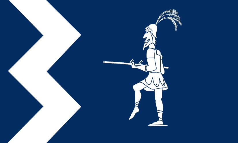
KINGSTANDING

Kingstanding was once in the Perry Barr township in the ancient parish of Handsworh in the Offlow hundred of Staffordshire. Kingstanding became part of Birmingham in 1928.
The name of the area is derived from the occasion when the Stuart King Charles I supposedly reviewed his troops standing on the Neolithic Bowl Barrow in the area on 18 October 1642 during the English Civil War.
The flag uses an image of a mounted cavalier while the red forms the shape of a letter K to represent Kingstanding.
Thanks to Adrian Bailey on Twitter for additional design input.
LADYWOOD
Ladywood was part of the ancient parish of Birmingham in the Hemlingford hundred of Warwickshire.
The flag uses an image of the statue of French daredevil Charles Blondin, who in 1873 undertook a tightrope walk across Edgbaston Reservoir. The statue was erected in 1995 and was created by sculptor Paul Richardson.
The colours of the flag are blue and white to represent the biblical figure of Mary, as the area used to be a wood known as St Mary’s Wood.

LONGBRIDGE

Longbridge was part of the Rednal yield of the ancient parish of Kings Norton in the Halfshire hundred of Worcestershire. Longbridge became part of Birmingham in 1911.
The river valley here is wide and marshy and the area is named after the long bridge that was built to cross the river at this point. The flag shows a bridge and river, while the wheel symbols are of the wheel of the first Austin car produced in 1906. The colours and small mast flags are taken from the Rover badge.
MOSELEY

Moseley was once part of the Moseley yield of the ancient parish of Kings Norton in the Halfshire hundred of Worcestershire. Moseley became part of Birmingham in 1911.
The griffon image and red colour are taken from the coat of arms of the Grevis family who used to own Moseley Hall. Moseley Rugby Club also use this emblem.
The circle is to represent the area’s supposed role in influencing J.R.R.Tolkien’s The Lord of the Rings (particularly Moseley Bog and the Ice House in Moseley Park – thought to be an inspiration for the Hobbit houses). The green stripe is to represent the village ‘green’.
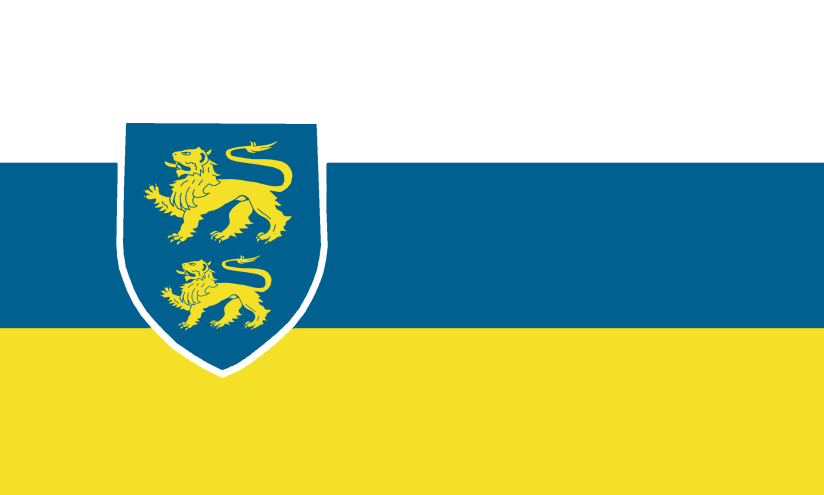
NORTHFIELD

Northfield was an ancient parish in the Halfshire hundred of Worcestershire. It became part of Birmingham in 1911.
The flag is based on the coat of arms of the Jervoise family who used to own the manor. The eagle image is taken from the family coat of arms. The name Northfield is by the white chevron pointing north and the green representing the fields.
PERRY BARR

Perry Barr was a township in the ancient parish of Handsworth in the Offlow hundred of Staffordshire. Handsworth became part of Birmingham in 1911.
The flag shows a pear tree on a hill (barr) which is thought to be the origin of the place name. The flag also features a podium to represent the area’s link to athletic prowess, being the home of Birchfield Harriers.
PYPE HAYES

Pype Hayes (or Pipe) was a sub-manor of Erdington in the ancient parish of Aston in the Hemlingford hundred of Warwickshire. It became part of Birmingham in 1911.
The flag is based on the coat of arms of the Bagot family who used to own the manor.
QUINTON

Quinton (or Ridgeacre as it used to be known) was a township in the ancient parish of Halesowen in the Brimstree hundred of the county of Shropshire (that’s not a typo, there was an exclave of Shropshire here until 1844). Quinton became part of Birmingham in 1909.
Quinton was once owned by Halesowen Abbey, so the flag uses the colours of the abbey crest, paired with a hammer and anvil to represent the early nail-making industry Quinton was known for (one of the oldest buildings in Quinton is the Old Nailer’s Cottage, which may date back to the 16th century).
RUBERY & REDNAL

Rubery and Rednal were part of the Rednal yield of the ancient parish of Kings Norton in the Halfshire hundred of Worcestershire. They became part of Birmingham in 1911.
The red hll represents Rednal Hill, which is part of the Lickey Hills. The rose and crown image represents The Rose & Crown, which was a coaching inn which stood at Rednal near the foot of the dangerous ascent of the Lickey Hills. A house replaced the inn, and the house eventually became The Old Rose and Crown Hotel. A New Rose and Crown pub is also located in Rubery.
The blue line is to represent the River Rea which flows through Rubery.
SALTLEY

Saltley was possibly once a parish in its own right, but was later a manor in the ancient parish of Aston in the Hemlingford hundred of Warwickshire. It became part of Birmingham in 1891.
The flag is based on the coat of arms of the Adderley family who built the original Saltley Hall.
SELLY OAK

Selly Oak was once a manor (then just called Selly) in the ancient parish of Northfield in the Halfshire hundred of Worcestershire. It became part of Birmingham in 1911.
There was an oak tree located on the corner of Oak Tree Lane and Bristol Road which is thought by some to give the area its name, though it’s likely that the source of the name was a much older tree.
Some later sources claim that the name refers to ‘Sarah’s oak’ (later Sally’s oak) after a local witch who was either hanged from it or was buried under it with an oak stake through her heart, which later it was claimed grew into an oak tree. source
The flag features two oak leaves and acorns.
SHELDON

Sheldon was an ancient parish in the Hemlingford hundred of Warwickshire. It joined Birmingham in 1931.
The image is a round buckle taken from the coat of arms of the Sheldon family who used to own the manor. The crook is to represent St Giles – the name of the ancient parish church.
SMALL HEATH

Small Heath was once part of the manor of Bordesley in the ancient parish of Aston in the Hemlingford hundred of Warwickshire. It became part of Birmingham in 1838.
The colours are taken from the coat of arms of Birmingham Council, which also used to be the badge for Birmingham City Football Club, which is based in Small Heath. The motorbike represents the BSA factory which used to be located here.
SPARKBROOK

Sparkbrook was once part of the manor of Bordesley in the ancient parish of Aston in the Hemlingford hundred of Warwickshire. It became part of Birmingham in 1838.
The flag features a triangle containing a balti bowl to represent the Balti Triangle. The wavy blue line with stars represents the Spark Brook, which gives the area its name.
SPARKHILL

Sparkhill was part of the ancient parish of Yardley in the Pershore hundred of Worcestershire. It became part of Birmingham in 1911.
The flag shows a hill with a star to represent a spark. The green and white stripes are taken from the badge of Sparkhill United FC.
STECHFORD

Stechford was part of the Lea manor in the ancient parish of Yardley in the Pershore hundred of Worcestershire. It became part of Birmingham in 1911.
The flag features a ford crossing the River Cole. Five roads, represented in yellow, meet at ‘Five Ways’, where the war memorial is represented by a pentagon. The green represents the greenspace along the river valley.
STIRCHLEY

Stirchley was part of the Moseley and Moundsley Yields of the ancient parish of Kings Norton in the Halfshire hundred of Worcestershire. Stirchley became part of Birmingham in 1911.
The flag shows the mill image, taken from the existing village sign, while the meeting of the Bourn and River Rea is represented by the wavy blue lines. The green colour represents the plentiful local greenspace.
SUTTON COLDFIELD

Sutton Coldfield was an ancient parish in Warwickshire. It became a municipal borough in 1882 before joining Birmingham in 1974.
The flag is based on the coat of arms of the former Sutton Coldfield Council, which in turn is based on the coat of arms of Bishop Vesey. The stag represents Sutton Park which was once a medieval deer park.
WARD END

Ward End was a manor once known as Little Bromwich within the ancient parish of Aston in the Hemlingford hundred of Warwickshire. It became part of Birmingham in 1891.
The flag is based on the coat of arms of the Ward family, after which the area is named.
WEOLEY CASTLE

Weoley Castle was once a manor (called Weoley) in the ancient parish in the Halfshire hundred of Worcestershire. It became part of Birmingham in 1911.
The flag features an image based on an artist’s representation of the gatehouse of Weoley ‘Castle’ (which, rather than being a castle was actually a fortified manor house). The red oval represents the castle square and this is overlaid on a Mercian cross to represent the area’s Anglo Saxon links. The yellow diagonals also represent the four roads leading to the square. On the castle is a raven which is the name of a local pub.
WEST HEATH

West Heath was part of the Rednal yield of the ancient parish of Kings Norton in the Halfshire hundred of Worcestershire. Longbridge became part of Birmingham in 1911.
The flag features an arrow pointing west. The purple colour is to represent heather (e.g. the heath). The man on the moon image is to represent the name of the local pub.
WINSON GREEN

Winson Green was part of the ancient parish of Birmingham in the Hemlingford hundred of Warwickshire.
The flag features a symbol representing the Soho Loop of the Birmingham Canal, being crossed by the Dudley Road and Winson Green Road, while the railway loops over the top.
The green colour is to represent the green of Winson Green. The white zigzag is a nod to the Birmingham flag.
YARDLEY

Yardley was an ancient parish in the Pershore hundred of Worcestershire. It became part of Birmingham in 1911.
The flag features the colours of Pershore Abbey who used to own lots of land here. The yellow ‘Y’ spells out the first letter of Yardley, while the three pears represent the area’s historic links to Worcestershire.

Great work Andy, well done. Excellent local history and design skills in tandem.
LikeLiked by 1 person
Thanks very much!
LikeLike
Druids Heath includes,other than the Drew family’s farmland, the manor of Bells Farm
“Bells Farm is mentioned as far back as the Doomsday Book.
It is thought to have derived its name from Hugh De Belne, who was granted land in the area by Edward I ‘for services as an excellent archer’ in or around the year 1300. So maybe a bow would be more appropriate as the golden symbol? I like the blue and green stripes idea though
LikeLiked by 1 person
That’s a great idea. Obviously my design is only one potential option for a flag for a flag for Druids Heath – I’m sure there are lots of other fab ideas out there
LikeLike
Absolutely fascinating detail; I really love this. My only ‘negative’ comment is that I was surprised not to see a Tudor rose featuring in the Sutton Coldfield flag.
LikeLiked by 1 person
There are many potential different options for a Sutton Coldfield flag – mine is just one of them 🙂
LikeLike
Absolutely marvellous. What an undertaking. As a Brummie for 80 years it was good to learn the history of the districts. Well done.
LikeLiked by 1 person
Thanks! Glad you enjoyd it!
LikeLike
Very impressive.
LikeLiked by 1 person
Thanks!
LikeLike
Lovely flags and great idea. I live in Solihull but also feel part of Birmingham as I live so close and was born in city hospital (called Dudley Road hospital at the time.) Like any proper Brummie I call the city centre town. Wonder if Solihull has a flag?
LikeLiked by 1 person
I don’t believe it does. perhaps one could be created based on the council’s coat of arms? https://www.solihull.gov.uk/About-Solihull/Solihull-Coat-of-Arms
LikeLike
Big historical connections…
Father’s family all over Black Country. Mother’s all over Birmingham. Me born Erdington, lived Streetly, then Little Aston. Loads of area connections family, ex colleagues and friends.
Brilliant idea and execution.
Congratulations and thanks.
LikeLiked by 1 person
Thanks 🙂
LikeLike
You have left out 2 townships fron the list, great barr and hamstead which are both areas within Birmingham with there own unique history
LikeLiked by 1 person
Hi Jack, for some reason I included these on the Black Country write-up (I suppose part of each place is arguably in Walsall and Sandwell respectvely): https://andyunderscore.com/2022/01/02/flags-of-the-black-country/
LikeLike